
Walking in the Hallerbos
 There are three marked trails in the Hallerbos.
The “Plateau” walk
Start at Parking 4 (Dries 3 – 1500 Halle) – 4 km – for visitors with limited mobility – white/black marked poles.
The trail is suitable for wheelchairs. At regular intervals there are benches and picnic tables.
The Sequoia Walk | gps (.gpx) track file
Start at the car park between the bridge over the R0 and the “Achtdreven” – 4 km – blue poles.
On this walk you will discover the conifers in the Hallerbos, the giant Sequoia trees.
The roebuck walk | gps (.gpx) track file
Start at the hunting lodge – 7 km – yellow posts. An adventurous walk. You walk along three of the four valleys in the Hallerbos.
Bluebell Walk
• There will be 2 marked Bluebell Walks in the Woods (from April 13th). One departing from Parking 1 (Hogebermweg) of 4,8 km and one from the Achtdreven of 5,1 km
• From Parking 11 (Houtveld) a 1,6 km walk is marked to the Achtdreven.
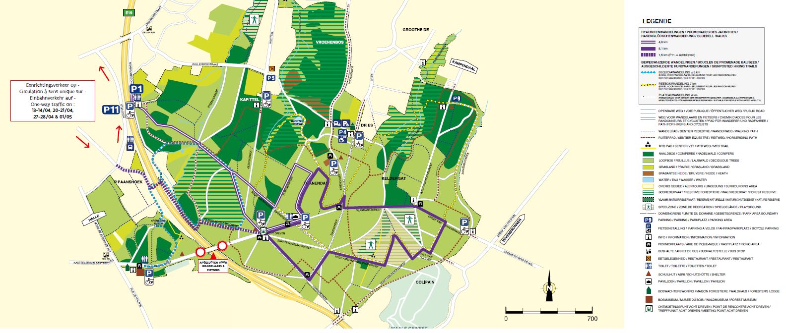
• The “Plateauwalk” (visitors with limited mobility) is on the central plateau of the forest and in the middle of the bluebells area.
• Slightly over half of the roebuck walk passes through the bluebell area.
You can follow the evolution of the flowering on: Bluebell flowering period